
Crawford County seat across the river
Barndominium Builders in Van Buren, AR
Shop houses and barndo homes for Van Buren and the Ozark-edge country of Crawford County.
- Free on-site estimates
- Written, line-item pricing
- County permit and septic research included
Van Buren Land, From River Bank to Ozark Foothill
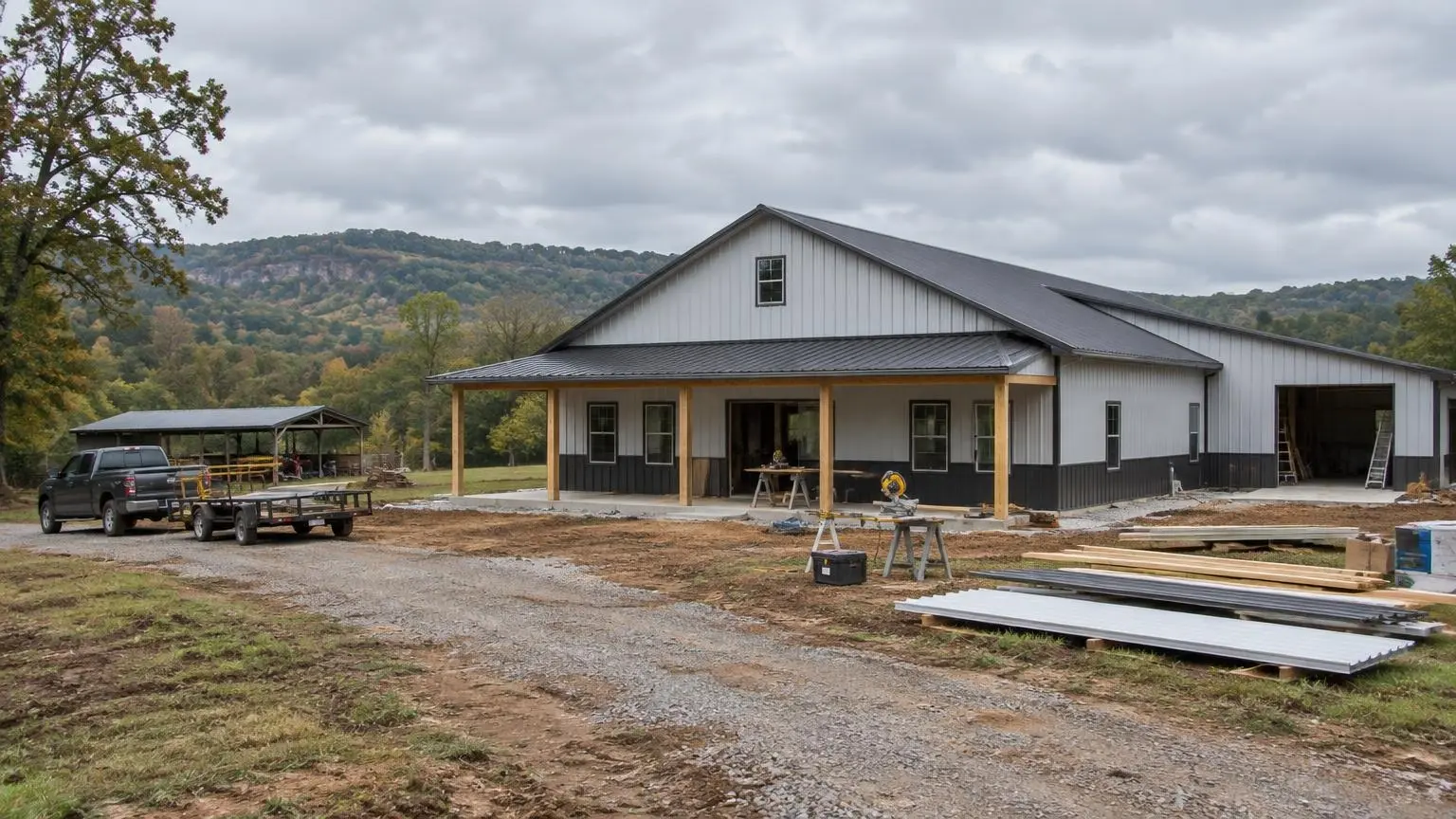
Barndominium builders in Van Buren work in a county seat that faces the river and backs into the hills. The Arkansas River forms the city's southern boundary and separates it from Fort Smith, the Oklahoma line is about two miles to the west, and Lee Creek flows through the west side of town into the river. Crawford County, which Van Buren anchors, is described as lying largely within the Ozarks, with only its extreme southern edge in the Arkansas River Valley. Drive north out of town and the land changes fast.
The town traces its roots to 1818 settlement and to a riverside fuel depot that supplied firewood to steamboats; that business later moved to higher ground, which is a lesson that still applies. Van Buren was incorporated on January 4, 1845, and today counts 23,218 residents as of 2020, with a 2025 estimate of 24,556.
A Build Timeline Tied to Van Buren Conditions
Before you buy: check the river and the creek
When the Arkansas River crested near Van Buren in late May and early June 2019, it reached nearly 41 feet, 21 feet above flood stage. The U.S. Geological Survey called it a 1-in-200-year event, with a peak flow of 570,000 cubic feet per second, and the crest topped the previous record of 38.1 feet. Flooding damaged 25 homes in the Crawford County area, and on May 28 a county levee slumped, threatening 250 people in 152 residences before the river crested on June 1 with the levee intact. If a tract you are considering touches low ground along the river or Lee Creek, the flood map and that 2019 history belong in your due diligence.
During design: lay out the septic setbacks
Many Crawford County tracts are outside city sewer. Arkansas Department of Health rules set fixed distances that decide where a drain field can go:
- 100 feet from the high-water mark of any stream or lake, which matters on creek frontage.
- 300 feet from the high-water mark of a water body within a quarter mile of a public water intake.
- 100 feet from any domestic water supply, and 10 feet from the house, other buildings, property lines and water service lines.
- 50 feet from a pond on the same property.
On a narrow tract running down to a creek, those numbers often push the house and field toward the road end of the property. We put them on the site plan first, then fit the floor plan around them.
During construction: build for wind
On April 21, 1996, an F3 tornado traveled about 7 miles through the Fort Smith and Van Buren area, killing two people and injuring 89. Around 1,800 homes were damaged, most of them in Van Buren. A barndominium can be designed for this: engineered column bases, properly specified anchors, rated large doors and an interior room that can serve as shelter. Each of those is far easier to include when the slab is poured than to add later.
Crawford County at a Glance
Crawford County covers 604 square miles, 593 of them land, and was formed on October 18, 1820. It counted 60,133 residents in 2020 and 25,300 housing units, with 9.1 percent vacant. Besides Van Buren, the county includes Alma, Cedarville, Dyer, Kibler, Mountainburg and Mulberry, and part of the Ozark National Forest lies within it. Interstates 40 and 49 intersect in the county, which is why tracts to the north and east stay within a reasonable drive of Fort Smith jobs.
Valley lots versus hill lots
On flatter valley ground near the river, our main questions are flood exposure, drainage and pad height. Farther into the Ozark side of the county, the questions shift to slope, driveway grade, rock near the surface and how much room is left for a septic field after the house and shop are placed. Arkansas rules also require bedrock separation of 18 to 36 inches below an absorption field depending on soil conditions, which can matter on shallow hillside soils.
Climate Notes for a Steel Home
Van Buren's climate table lists about 45.40 inches of precipitation a year, average temperatures from about 36 degrees F in January to 81 in July, and records of 113 degrees in 1936 and minus 15 in 1899. Metal roofs and walls respond quickly to that kind of swing. We plan insulation that separates the steel skin from the conditioned space, vapor control that suits a humid climate and ventilation for the shop side so tools and vehicles do not sit in condensation.
What to Send Us
A parcel number or address, a survey if you have one and a short list of what you want: bedrooms, shop bays, door sizes, porches. We will check the flood map, sketch the septic setbacks and give you a written estimate for the shell and finish-out. Call (501) 392-9924 or
.Van Buren and Crawford County Facts
- 2019 river crest. The Arkansas River crested near Van Buren at nearly 41 feet, 21 feet above flood stage; USGS rated it a 1-in-200-year flood.
- 1996 tornado. An F3 tornado on April 21, 1996, damaged around 1,800 homes, most of them in Van Buren.
- Lee Creek. Lee Creek runs through the west side of Van Buren into the Arkansas River; state rules keep septic fields 100 feet from a stream's high-water mark.
- County terrain. Crawford County lies largely within the Ozarks, with only its southern edge in the Arkansas River Valley.
- Housing stock. Crawford County had 25,300 housing units in 2020, 9.1% of them vacant.
Our Services in Van Buren, AR
Van Buren Questions
How high did the river get at Van Buren in 2019?
It crested at nearly 41 feet, 21 feet above flood stage, above the previous record of 38.1 feet. We use that event, along with the flood map, when judging low ground near the river.
I have land on Lee Creek. How close can the septic field be to the water?
State rules require 100 feet from the high-water mark of a stream, and 300 feet if the water body is within a quarter mile of a public water intake. We map that line before placing the house.
Is building in the hills north of Van Buren harder?
It is different. Slope, rock and driveway access drive the site work, and the septic field needs enough soil above bedrock. We walk the site before pricing excavation.
Do you build around Alma, Mulberry and Cedarville?
Yes. Rural Crawford County land is a natural fit for barndominiums and shop houses, and we plan each site on its own terms.
Free Estimates in Van Buren, AR
Get a written estimate for your Van Buren or Crawford County barndominium.
Barndominium Builders Near Van Buren
- Barndominium Builders in Little Rock, AR
- Barndominium Builders in Conway, AR
- Barndominium Builders in Cabot, AR
- Barndominium Builders in Benton, AR
- Barndominium Builders in Bryant, AR
- Barndominium Builders in Sherwood, AR
- Barndominium Builders in Maumelle, AR
- Barndominium Builders in Searcy, AR
- Barndominium Builders in Beebe, AR
- Barndominium Builders in Russellville, AR
- Barndominium Builders in Hot Springs, AR
- Barndominium Builders in Malvern, AR
- Barndominium Builders in Arkadelphia, AR
- Barndominium Builders in Pine Bluff, AR
- Barndominium Builders in Jonesboro, AR
- Barndominium Builders in Paragould, AR
- Barndominium Builders in Batesville, AR
- Barndominium Builders in Mountain Home, AR
- Barndominium Builders in Harrison, AR
- Barndominium Builders in Fayetteville, AR
- Barndominium Builders in Springdale, AR
- Barndominium Builders in Rogers, AR
- Barndominium Builders in Bentonville, AR
- Barndominium Builders in Siloam Springs, AR
- Barndominium Builders in Fort Smith, AR
- Barndominium Builders in Clarksville, AR
- Barndominium Builders in Texarkana, AR
- Barndominium Builders in El Dorado, AR
- Barndominium Builders in Magnolia, AR